April 30, 2015

Day 73

Temperature: 67 °F,  feels like 67 °F
Humidity: 28%
Dew Point: 33 °F
Wind: 2.2 mph N with 6 mph gusts
Pressure: 30.03 in
Visibility: 10 miles
Cover: Clear
Observation: 4:30 PM
Moon: Waxing Gibbous, 90% visible


Source: http://wxug.us/19tg2

Today has almost exactly the same weather as yesterday, but the winds have been just that much cooler. It took a couple extra hours than yesterday to warm up to the high temperature of 67 °F. It has been mostly clear with light hazy clouds that are not thick or high enough to block the sun. The air is pretty dry and we have no chance for precipitation today or tonight. Tomorrow it will be sunny in the morning with increasing clouds into the afternoon. A few moist pockets of clouds will be passing through in the afternoon and the evening giving us a slight chance for a small shower around 1 pm and 7 pm, but it is pretty unlikely. There is a thunderstorm predicted for Sunday afternoon (fingers crossed) that could be caused by a shift in winds from the south and a line of storms riding a cold front in our direction. 

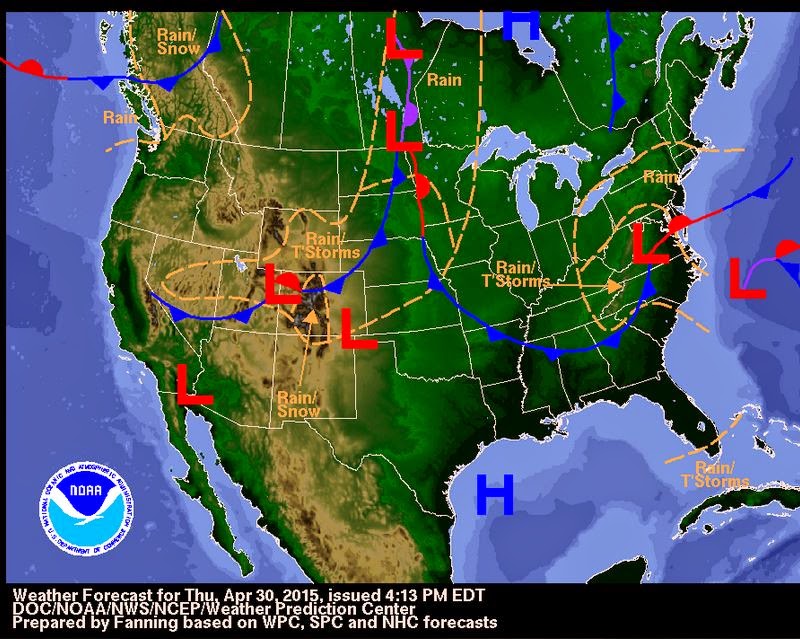
National Weather Forecast Map for 4/30/15


April 29, 2015

Day 72

Temperature: 66.9°F,  feels like 66.9°F
Humidity: 17%
Dew Point: 22 °F
Wind: 7.6 mph N with stronger gusts
Pressure: 29.94 in
Visibility: 10 miles
Cover: Clear
Observation: 5:30 PM
Moon: Waxing Gibbous, 84% visible

Source: http://wxug.us/19tg2

Today was a bit cooler than yesterday with stronger winds because the jet stream has moved farther east so the path is over us instead of next to us. The high for today was around 66°F with low humidity and mostly clear skies. There have been a few very thin altostratus clouds passing by and some have been thick enough to block sunlight for a few seconds before moving on, but most have been very whispy and thin. We should expect similar weather tomorrow: clear, sunny, and little moisture. But by Friday the winds will shift to coming from the south and bringing up moisture from the Gulf and meeting with the cold front and low pressure system currently over the Rockies and this will likely bring rain and a chance of thunderstorms Friday afternoon. 


April 28, 2015

Day 71

Temperature: 69.8°F,  feels like 69.8°F
Humidity: 20%
Dew Point: 27 °F
Wind: .7 mph N, with 5.4 mph gusts
Pressure: 30 in
Visibility: 10 miles
Cover: Overcast 10000 ft
Observation: 6:30 PM
Moon: Waxing Gibbous, 77% visible

Source: http://wxug.us/19tg2

Today was yet again sunny and around 75 °F with light breezes and increasing cloud cover throughout the day. Right now we have overcast skies and a 20% chance of rain as a parcel of rain that is picking up moisture over the Great Lakes. With as quickly as the sky cover increased, I believe we may see a little of that precipitation by 9pm. Another high pressure system will be passing over us tomorrow bringing bright, sunny skies but cooler temperatures, with a high of only 67°F. The winds are still coming in from the north but we are in a section of a shortwave jet stream that is following a ridge.


April 27, 2015

Day 70

Temperature: 68.5 F, feels like 68.5 F
Humidity: 20%
Dew Point: 26 F
Wind: 0 mph N, with gusts
Pressure: 30.09 in
Visibility: 10 miles
Cover: Clear
Observation: 6:30 PM
Moon: Waxing Gibbous, 68% visible

Source: 

Today was a beautiful day! The skies were completely clear and full of sunshine and there were light, warm winds with no precipitation. We are currently under a high pressure system, but there is a cold front and low pressure system attached to rain headed our way from Canada/Minnesota/the Dakotas. Tomorrow will be mostly cloudy with a chance for rain and around the same air temperature as today's. The country currently has a couple different high pressure systems in the plains area with a few low pressure systems on the west coast and Gulf of Mexico. Even with the high pressure systems, we should expect mostly cloudy skies with some chance of rain. 


April 26, 2015

Day 69

Temperature: 62 F, feels like 62 F
Humidity: 25%
Dew Point: 26 F
Wind: 3.0 mph N
Pressure: 30.08 in
Visibility: 10 miles
Cover: Clear
Observation: 4:30 PM
Moon: First Quarter, 59% visible

I was out of town for the weekend, so this post is intended to record yesterday and today. Yesterday was sunny and mostly clear with cooler air temperatures and gustier wind. There were a few upper level stratus clouds that moved along throughout the day:


Today is warmer than yesterday with stronger gusts and clearer skies. We are currently under an open area between fronts with very little chance for precipitation in the next few days. This week will be mostly sunny and highs in the upper 60s. 


April 23, 2015

Day 68

Temperature: 52 F, feels like 52 F
Humidity: 14%
Dew Point: 4 F
Wind: 3.2 mph W
Pressure: 30.01 in
Visibility: 10 miles
Cover: Clear
Observation: 7:30 PM
Moon: Waxing Crescent, 31% visible

Source: http://wxug.us/19tg2

Today was much cooler this morning and got warmer as the day wore on. The wind now is much warmer than the wind this morning because it shifted from North-northwest to westerly winds. We are still in the trough of cool air from the continental polar jet stream, but by next week we should be under the ridge and have warmer, sunnier days. Tomorrow will be mostly cloudy with a low chance for precipitation all day and with the likelihood increasing into the evening hours.


April 22, 2015

Day 67

Temperature: 47.5 F, feels like 44 F
Humidity: 38%
Dew Point: 23 F
Wind: 6.8 mph NE
Pressure: 29.84 in
Visibility: 10 miles
Cover: Partially cloudy 7000 ft
Observation: 4:30 PM
Moon: Waxing Crescent, 20% visible

Source: http://wxug.us/19tg2

Today felt much cooler than yesterday; most students were pulling out their fall coats and scarves again to walk around campus. It was completely overcast earlier but since noon or so the clouds began to break up and now you can see blue sky between the altocumulus duplicatus clouds. There is a very low chance for precipitation today and tomorrow, but by Friday there is an increased chance for rain. Today appears to be the last cool day for a while as the average high temperatures are expected to rise over the next week. By next Wednesday we should have 60-70 F degree days again. A high pressure system and a cold front are currently passing over us and another attached to a warm front should be following behind bringing us the warmer, dryer weather next week.


April 21, 2015

Day 66

Temperature: 40 F, feels like 35 F
Humidity: 99%
Dew Point: 40 F
Wind: 8.9 mph W
Pressure: 29.60 in
Visibility: 9 miles
Cover: Mixed sky, Overcast 8500 ft
Observation: 5:30 PM
Moon: Waxing Crescent, 13% visible

Source: http://wxug.us/19tg2

Today's weather has been very erratic. We have had sunshine, hail, snow, and rain at different intervals. The polar jet stream is currently swooping over our area and bringing cool moist air down from Canada and picking up more moisture as it travels farther northeast. This morning started as cold and gray, but by mid-morning around 10 am we had large flakes of snow that didn't stick. Throughout the afternoon we have had other instances of flurries that did not stick and around 4:30 we had some small hail and rain/snow mix that lasted only a few minutes. The winds are picking up as the evening passes but the chance for snow will decrease as the night wears on. Tomorrow it will be a little bit warmer than today but with a much reduced chance of precipitation. 


April 20, 2015

Day 65

Temperature: 42 F, feels like 36 F
Humidity: 99%
Dew Point: 41 F
Wind: 8.9 mph W
Pressure: 29.47 in
Visibility: 10 miles
Cover: Overcast 4200 ft
Observation: 6:00 PM
Moon: Waxing Crescent, 6% visible

Source: http://wxug.us/19tg2

Today is a lot colder than yesterday and has been mostly cloudy all day. There were a few peeks of sun here and there this morning but since noon it has been mostly cloudy. The air is pretty moist but the wind is so cool and blowing that it doesn't feel very humid. We are currently between concrete pressure systems but the cold front and low pressure system that just passed through is definitely sticking around. We have a chance for rain later tonight and tomorrow there is a 40-50% chance for snow tomorrow :(


April 19, 2015

Day 64

Temperature: 51.6 F, feels like 51.6 F
Humidity: 98%
Dew Point: 51 F
Wind: 1.7 mph W
Pressure: 29.36 in
Visibility: 1.8 miles
Cover: Overcast 2700 ft
Observation: 7:30 PM
Moon: New Moon, 2% visible

Source: http://wxug.us/19tg2

Yesterday was sunny and warm with big puffy clouds. There was increasing cloud cover as the day wore on and eventually the skies were overcast and there was a light rain/mist around 9 pm and into the evening. Overnight there were intermittent rain showers that have continued into today. The wind is low and from the west, and with the cloud cover, it feels warmer than 50 F, even in the rain. I went for a hour or so walk and it was comfortable to be out in a raincoat and basic layers. There is currently a low pressure system attached to a warm front going over us right now, but a cold front with the same front is close behind. This will cause lower temperatures the next couple days with even a chance for snow. The winds are also expected to pick up, with occasional gusts that could be around 20 mph. Tomorrow will be cooler than today with a chance for showers.


April 17, 2015

Day 63

Temperature: 77.9 F, feels like 79 F
Humidity: 46%
Dew Point: 55 F
Wind: 6.3 mph WNW
Pressure: 30.00 in
Visibility: 10 miles
Cover: Clouds 7000 ft
Observation: 3:30 PM
Moon: Waning Crescent, 1% visible

Source: http://wxug.us/19tg2

Yesterday and today are basically the same day. High temperatures in the upper 70s, bright and sunny with a few puffy cumulus clouds passing through the sky, light breeze: the whole nine yards of perfect days. Last night was pretty warm and cloudy with lows in the upper 40s. There is no rain expected for today and tomorrow, but by Sunday, the rain and low pressure system that is currently to the north of us in Canada attached to a cold front will make it to our latitude. Tomorrow should also be bright and sunny but with increasing cloud cover and a little cooler, ONLY a high of 70 F. What an amazing April so far in Wisconsin!


April 15, 2015

Day 62

Temperature: 71 F, feels like 72 F
Humidity: 11%
Dew Point: 12 F
Wind: 3.8 mph ESE
Pressure: 30.21 in
Visibility: 10 miles
Cover: Clear
Observation: 2:30 PM
Moon: Waning Crescent, 13% visible

Source:http://wxug.us/19tg2

Today is another bright, sunny, and warm day with little to no chance for precipitation. I think these are the kind of days in Wisconsin that convince people to stay in the state. Right now we have east/southeast winds that are being pulled up to the low pressure system currently above us in Canada. I believe this system which is attached to a cold front will reach us by Sunday and bring cooler temperatures and rain. Today and the rest of the week appear to be pretty calm. The current LI value is high so everything is pretty stable.


April 14, 2015

Day 61

Temperature: 67.3 F, feels like 67.3 F
Humidity: 7%
Dew Point: 7 F
Wind: 3.7 mph SE
Pressure: 30.1 in
Visibility: 10 miles
Cover: Clear
Observation: 2:30 PM
Moon: Waning Crescent, 22% visible

Source: http://wxug.us/19tg2

Today has been sunny and warm with clear skies. There is a slight haze of airplane trails in the upper levels of the atmosphere but otherwise no clouds besides some spread out airplane contrails. We are currently under a high pressure system and there are multiple low pressure systems to the west and south of us, so the winds in Eau Claire are pretty light and breezy. The air is dry and a little cool in the shade and no precipitation is expected today. Cloud cover will move into the area tomorrow night, brought by the low pressure system and cold front currently on the west side of the Rockies. Temperatures are expected to stay around the mid-60s the rest of this week and then the winds are going to switch from south/southwest to north/northwest around Sunday and temperatures will be a bit lower (mid 50s) next week.


April 13, 2015

Day 60

Temperature: 61 F, feels like 61 F
Humidity: 25%
Dew Point: 25 F
Wind: 3 mph W
Pressure: 29.99 in
Visibility: 10 miles
Cover: Few 8500 ft
Observation: 2:30 PM
Moon: Waning Crescent, 32% visible

Sourcehttp://wxug.us/19tg2

Today is cooler than yesterday and the winds are less strong. There were bright blue and mostly clear skies this morning but it has gotten cloudier throughout the day. Here is a picture of the cumulus clouds over campus right now:


There is currently no chance for rain today or tomorrow and both days are expected to be in the mid 60s with warm South/Southwesterly winds and sunshine. There is currently a low pressure system over us that is pulling warm, dry wind from the west over to Minnesota/Wisconsin. The system is attached to a cold front which explains why today is so much cooler than yesterday. The high pressure system currently over Canada will come down to us this week and stick around bringing stable temperatures and little precipitation. However, the low pressure system and cold front off the west coast may make it to us by this weekend and bring more moist air.


April 12, 2015

Day 59

Temperature: 71 F, feels like 76 F
Humidity: 59%
Dew Point: 56 F
Wind: 12.5 mph SSW
Pressure: 29.81 in
Visibility: 10 miles
Cover: Overcast 9500 ft
Observation: 1:30 PM
Moon: Last Quarter, 43% visible


Source: http://wxug.us/19tg2


Yesterday did get as warm as they said it would and it was absolutely lovely! 65 F and sunny all day with a light breeze and partly cloudy. Today is much of the same except warmer and with stronger winds and more clouds. These clouds are higher in the atmosphere than yesterdays, I believe they are altocumulus clouds because they are fleecy looking and stretched in bands. Right now we are still under a high pressure system and warm sunny weather will be a trend for the week. There is a collection of systems on the southern edge of the Rockies that may get to us by Wednesday and give us a chance for rain again, but for the most part, the wind will continue to come from the south and west this week and bring warm, dry air. 


Current image of the strong southern winds 

April 10, 2015

Day 58

Temperature: 37 F, feels like 37 F
Humidity: 95%
Dew Point: 36 F
Wind: 2 mph NNW
Pressure: 29.86 in
Visibility: 10 miles
Cover: Overcast 1100 ft
Observation: 1:30 PM
Moon: Waning Gibbous, 66% visible

Source: http://wxug.us/19tg2 

Today we woke up to snow covered rooftops and cars but everything has mostly melted away by now. Originally today was predicted to be partly cloudy and in the low 50s, but I doubt it will warm up that much. The cold front attached to all of the precipitation has passed through now, but even with the high pressure system coming down from Canada behind it, I don't think we will get the 65 and sunny for tomorrow like they are predicting. The winds are still coming down from the north right now which is keeping things cool, but the winds are expected to shift to south/west winds overnight because of the high pressure systems on the west coast and the low pressure systems on the east coast. 

http://earth.nullschool.net/#current/wind/surface/level/orthographic=-93.57,36.21,1024 


April 9, 2015

Day 57

Temperature: 40 F, feels like 40 F
Humidity: 90%
Dew Point: 38 F
Wind: 1 mph N
Pressure: 29.64 in
Visibility: 10 miles
Cover: Overcast 1300 ft
Observation: 2:30 PM
Moon: Waning Gibbous, 73% visible

Today started with periods of heavy rain lasting until around noon. Since then the ground has completely dried up and it has been gray and overcast with low altitude clouds. Right now it is down pouring and more rain is expected tonight as the temperature drops but the LI value is pretty stable so I do not think there will be thunderstorms. There is low pressure system tied to a cold front over our area right now, but warmer air attached to a high pressure system currently over Nebraska should move in by this weekend to give us a break from the rain/cold. (Hopefully sunshine for the Viennese Ball!) 


April 8, 2015

Day 56

Temperature: 46 F, feels like 46 F
Humidity: 73%
Dew Point: 38 F
Wind: 1 mph ESE
Pressure: 30.01 in
Visibility: 10 miles
Cover: Overcast 1500 ft
Observation: 2:30 PM
Moon: Waning Gibbous, 83% visible

Today is cool but warmer and drier than yesterday. There is little to no chance for rain today but there is a high chance for rain tomorrow as Northeast winds continue to come across the Great Lakes and meet the low pressure system and stationary front to the south of us. There is a trough of low pressure attached to the end of this stationary front over the Rockies which is pulling moisture to this area; heavy snow is expected. The ring of high pressure systems around the United States is finally getting parched landscapes the precipitation one can expect in April. By this weekend the winds should shift from the north to the south and temperatures are expected to rise, along with a greater chance for thunderstorms. Temperatures are expected to rise to the mid 60s so the increased heat and moisture could produce some stronger storms. The current LI index for the Twin Cities is at 14.3, but I will be watching it in the coming days to determine the severity and prevalence of the upcoming storms. 


April 7, 2015

Day 55

Temperature: 39 F, feels like 34 F
Humidity: 99%
Dew Point: 40 F
Wind: 7.8 mph ESE
Pressure: 30.11 in
Visibility: 10 miles
Cover: Cloudy 3700 ft
Observation: 5:30 PM
Moon: Waning Gibbous, 89% visible

Today has been gray and overcast all day with temperatures in the mid 40s and cool, moist winds. We will be getting rain around 8-9pm and then likely again during the overnight hours. There is a strong storm with heavy rain hitting La Crosse right now, but we are only getting light rain from the fringe of the storm. There is an occluded front to the south of us that is very slow moving which explains the last few days of cool weather. There is also a high pressure system to the north of us and a low pressure system to the south, so there is cool moist air being pulled across the Great Lakes through the Midwest as well. Tomorrow will be warmer than today but still overcast with a low chance for precipitation.